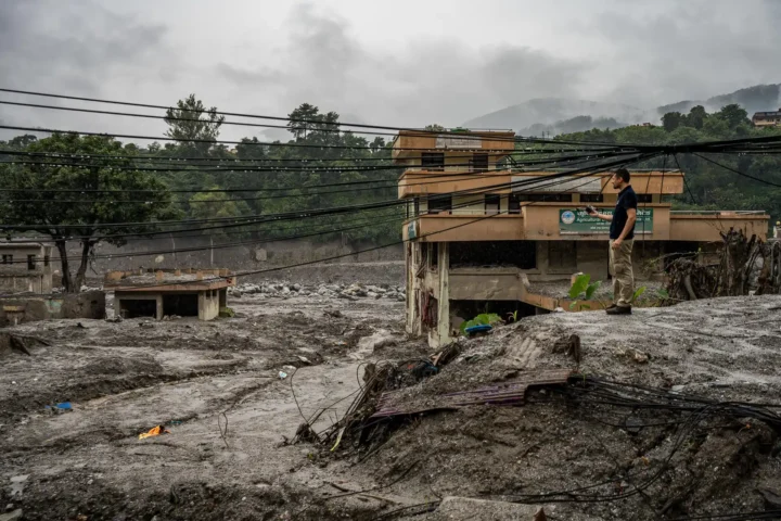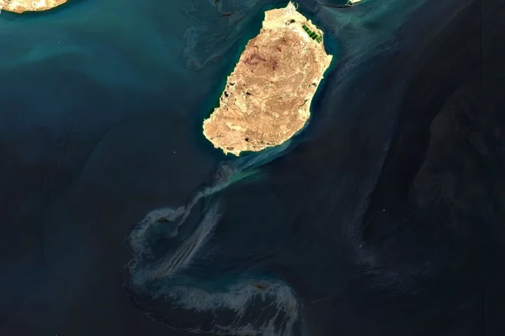
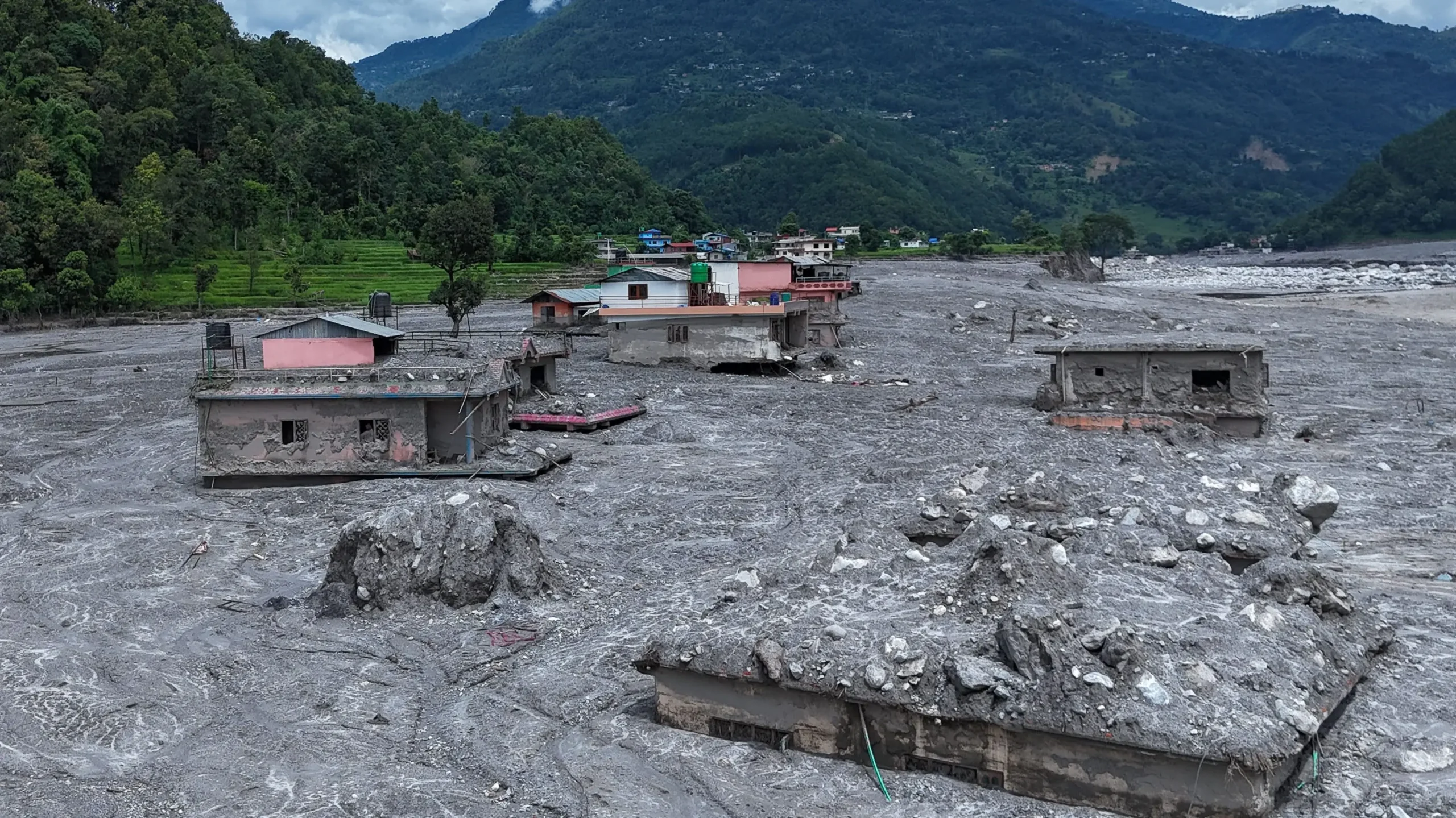
On the morning of Aug. 26, a slab of ice and rock tore free from the north face of Langtang Lirung, a 7,200-meter peak on the Nepal-Tibet frontier. The U.S. Geological Survey first registered the event as a modest earthquake. It was not. Scientists later described a collapse equivalent to a magnitude 5.2 shock: bedrock and glacier ice plunging more than a kilometer into a high valley, crushing into a slurry of water, ice and stone that raced down the Lhende Khola and into the Bhotekoshi-Trishuli system. Within hours the surge had scoured villages, snapped bridges, filled hydropower tunnels with mud, and erased the Gyirong-Rasuwagadhi border complex that handles a large share of China-Nepal trade.
By Sept. 5, Nepal’s disaster authority had counted 1,344 recovered dead and nearly 5,000 missing, among them hundreds of foreign pilgrims and trekkers and more than 600 children in two districts. Chinese authorities reported more than 20 dead and hundreds missing in Gyirong County. Teams were still digging at underground powerhouses. A woman was pulled alive from debris on the tenth day. This is not a natural disaster in the old sense. It is a compound event: a warming cryosphere, a young mountain chain, and a development model that treats the world’s highest range as a construction site on the plains.
The Himalayas are not old stone. They are among the youngest, fastest-rising mountains on Earth, still being shoved upward as the Indian plate drives under Eurasia. Their slopes are fractured by the Main Central Thrust and a lattice of active faults. The rock is often crushed, the soils thin, the valleys steep and narrow. Rain that would be inconvenient on the Ganges plain becomes a debris torrent here. Snow that used to fall as snow now arrives, more often, as rain at elevations where ice once locked the slopes in place. Permafrost that acted as a hidden mortar is thawing. Glacial lakes are multiplying behind moraines that were never engineered to hold them.
None of this is speculative. The Hindu Kush Himalaya, the so-called Third Pole, is warming well faster than the global mean—on the order of 0.2 to 0.3 degrees Celsius per decade, and locally higher on the Tibetan plateau. ICIMOD’s glacier outlook this year reported that ice-loss rates have roughly doubled since 2000. Between 1990 and 2020 the region lost about 12 percent of its glacier area. Nearly nine in ten mass-balance years recorded since the mid-1970s have been negative. Some 200 glacial lakes across the range are classified as potentially dangerous; Nepal lists 47 in its three main basins. The ice is leaving. The water has to go somewhere.
Glacier Loss & GLOF Risk
Interactive visualisation of glacier-area change across Himalayan sub-regions, Ganga basin glacier contraction, and the long-run High Mountain Asia GLOF inventory.
Glacier area loss by Himalayan sub-region
1990–2020 · hover or tap a bar for details
Ganga basin glacier area
Change from 1990 to 2020
Area lost
0 km²
High Mountain Asia GLOF inventory
Documented inventory totals, 1533–2025
Inventory starts
1533documented period →
Inventory ends
2025What turns a hazard into a catastrophe is what we put in the path of that water.
Look downstream from Langtang. The Bhotekoshi-Trishuli corridor is lined with run-of-river hydropower plants, worker camps, highway cuts and border logistics. The flood of Aug. 26 was not the first warning on that exact route. In July 2016 a moraine-dammed lake in Tibet’s Poiqu basin burst and damaged the Arniko Highway and the Upper Bhotekoshi plant. On July 8, 2025, the sudden drainage of a supraglacial lake on the Tibetan side took out the Friendship Bridge at Rasuwagadhi and killed at least nine people. Thirteen months later the same funnel delivered a far larger pulse. Hydropower tunnels became tombs. The dry port and customs yard at the confluence sat exactly where a mountain river, given enough sediment and slope, will always want to go.
This is the pattern across the central and western Himalaya, and it is not confined to one country.
In June 2013, extreme rain and the outburst of Chorabari Lake above Kedarnath sent a wall of water down the Mandakini. More than 5,000 people died. The World Bank and Asian Development Bank put the economic loss near $3.8 billion. A decade of inquiries reached the same uncomfortable conclusion: pilgrimage towns and hydropower works had crowded the floodplain of a river that was never tame.
In February 2021, an ice-and-rock avalanche in Chamoli district, Uttarakhand, roared down the Rishiganga and Dhauliganga. It erased the Rishiganga plant, wrecked the Tapovan Vishnugad project, and killed or left missing some 200 people, most of them construction workers. The geology was familiar: a steep hanging glacier, thawing ice, a gorge too narrow to dissipate energy, and powerhouses sited where the surge had nowhere to go but through the works.
On the night of Oct. 3, 2023, some 14.7 million cubic meters of frozen moraine collapsed into South Lhonak Lake in Sikkim. A wave up to 20 meters high breached the frontal moraine and released about 50 million cubic meters of water. The flood traveled 385 kilometers down the Teesta, triggered 45 secondary landslides, mobilized on the order of 270 million cubic meters of sediment, and destroyed the 1,200-megawatt Teesta III dam at Chungthang. Officials counted 55 dead and dozens missing. The moraine had been moving for years. The dam sat in the path of a lake everyone knew was growing.
On Aug. 5, 2025, a debris flow tore through Dharali in Uttarkashi, on a fan below the Srikanta Glacier. The market and riverside hotels—built for the Gangotri pilgrimage trade—were buried. Scientists at the Wadia Institute of Himalayan Geology described water pooling in moraine and rain falling where snow once locked the slope, onto a settlement placed on the surface a mountain stream uses to dump its load. A 2026 paper in the journal Landslides was blunt about that monsoon across the northwestern Himalaya: rainfall was the trigger; the scale of death and damage came from roads and buildings on ground that cannot hold them.
Uttarakhand’s Char Dham highway project is the emblem of this habit. Conceived as an all-weather corridor to four shrines, it has been driven through as a 12-meter plains-style road, sliced into 53 segments to stay under environmental-assessment thresholds. A University of Potsdam study of the Rishikesh-Joshimath stretch counted more than 300 road-blocking landslides after the 2022 rains—about 1.25 per kilometer—and found that widening roughly doubled the incidence of blockages. Subsequent work has shown that most new slides cluster within a hundred meters of the cut. Joshimath, the garrison and pilgrim town on an old landslide, developed cracks in hundreds of houses. Satellite measurements recorded several centimeters of subsidence in days. Hydropower tunneling on the Dhauliganga and road cutting at the toe of the slope were not the only causes, but they were not innocent bystanders either.
Nepal’s own energy strategy has followed the same gorge-by-gorge logic. Dozens of run-of-river plants sit on the Trishuli, Marsyangdi, Tamakoshi and other snow-fed rivers. They look clean on a spreadsheet. In a debris flood they become multipliers: they trap workers, they fail in sequence, they send a second pulse of water and wreckage downstream. ICIMOD and independent hydrologists have warned for years that a large share of existing and planned Himalayan hydropower lies on potential glacial-lake outburst paths, and that design floods based on rainfall statistics do not capture an ice-rock avalanche. The Aug. 26 flood took hundreds of megawatts offline in a single afternoon.
The pressure does not stop at national borders, and it does not originate only in Kathmandu or Dehradun. The Tibetan plateau is the headwaters of the rivers that feed South Asia. Over the past decade it has been laced with a density of high-altitude engineering that has no real precedent: highways blasted through gorges, long tunnels, railways that spend most of their length underground or on viaducts, border ports and new settlements pushed onto fans and confluences, and a new generation of cascade hydropower. Open-source mapping after the Nepal flood counted scores of such assets along the Himalayan rim of the Tibet Autonomous Region. Gyirong Port, a Belt and Road node and the principal overland gate into central Nepal, sat at the meeting of the Lhende Khola and the Trishuli. It was damaged in 2025 and all but erased in 2026. That is not an argument that a customs yard caused a glacier to fail. It is an argument that heavy civil works at a Himalayan confluence, filled with workers, trucks and tourists, convert a slope failure into a regional emergency.
Farther east, construction began in July 2025 on the lower Yarlung Tsangpo cascade near Medog—the so-called project of the century, budgeted at some 1.2 trillion yuan, designed to generate on the order of three times the output of the Three Gorges Dam. The river drops nearly 2,000 meters in a short, seismically active gorge before it becomes the Siang and then the Brahmaputra. Whatever one’s view of the geopolitics, the sustainability question is narrower and harder: What does it mean to pin the energy future of a continent to tunnels and powerhouses in one of the least stable mountain syntaxis on Earth, upstream of tens of millions of people, at the same moment that permafrost, glaciers and monsoon extremes are all moving in the wrong direction? The same question applies, at smaller scale, to every new high dam and every new two-lane cut on the Indian and Nepali side. The mountains do not care which flag flies over the camp.
A 2022 paper in Nature Geoscience put the problem in the language engineers prefer. Warming is destabilizing rock and ice across High Mountain Asia. Sediment loads are rising. Reservoirs silt. Dams designed for a 20th-century rain flood can be overtopped by a 21st-century ice-and-rock cascade. Two-thirds of Himalayan hydropower projects, the authors noted, sit on potential outburst-flood pathways. That was four years and several wrecked plants ago.
The political reflex after each disaster is the same. Declare a national tragedy. Promise early-warning systems. Announce that reconstruction will be greener. Then widen the next stretch of highway before the monsoon, restart the next tunnel, and reopen the pilgrimage season because the hotels are built and the loans are due. Tourism and hydropower are not sins. Connectivity is not optional for mountain communities that have been isolated for centuries. The error is the template: plains geometry imposed on a thrust belt, bulk blasting in seismic rock, settlements on debris fans, worker camps in the throat of gorges, and transboundary projects advanced faster than transboundary monitoring.
A sustainability standard for the Himalaya would look almost boring next to the rhetoric of corridors and cascades. It would begin with carrying capacity: a valley can support only so many beds, trucks and megawatts before the next debris flow writes off the investment. It would require slope-scale geological mapping before a bench is cut. It would keep roads closer to the 5.5-meter hill standard India’s own engineers once recommended above the Main Central Thrust, not a 12-meter carriageway that doubles the landslide count. It would site energy where the failure of a plant does not kill the people who built it. Distributed power on lower ridges is less photogenic than a 1,200-megawatt wall. It also does not trap workers in a tunnel.
It would treat information as infrastructure. The Langtang face showed change in the days before failure. The South Lhonak moraine had been creeping for years. The 2025 Rasuwagadhi flood was a dress rehearsal. What was missing was not satellite imagery. It was a duty to share it across the ridge line in hours, not after the bodies are counted. Glacial lakes and river stages do not hold passports. Early warning that stops at a customs post is not a system.
It would impose moratoriums where the geology has already voted. Certain stretches of the Mandakini, Alaknanda, Dhauliganga, Teesta, Bhotekoshi and Trishuli have now demonstrated, repeatedly, that they will not host dense linear infrastructure on present terms. Rebuilding the same alignment in concrete is not resilience. It is a subscription to the next invoice. Joshimath should have ended the argument about tunneling under a town that sits on old slide debris. Dharali should have ended the argument about markets on active fans. Gyirong-Rasuwagadhi should now end the argument about dry ports at Himalayan confluences.
Climate change is the accelerant. It is not a license to ignore the match. Nepal’s emissions are negligible; Uttarakhand’s are not the reason a glacier detaches. The moral claim those places can make on large emitters is real, and it should be paid in finance for adaptation, not in lectures. But no climate fund will stabilize a slope that has been over-steepened by a road cut, or move a powerhouse out of a gorge after the loan is disbursed. That is a planning choice. It is being made every week, in tender documents from Shigatse to Siliguri.
The people who die in these floods are not abstractions. They are tunnel laborers from the plains, pilgrims walking to Kailash, children in Rasuwa and Nuwakot, shopkeepers in a Uttarkashi bazaar, soldiers at a border post. They are told that the road will bring prosperity and the dam will bring light. Too often the road brings a landslide and the dam brings a second wave.
The Himalaya still performs work no dam can replace. It stores winter water in ice and releases it in spring. It anchors the monsoon. It holds soils that would otherwise wash to the Bay of Bengal in a season. Nearly two billion people live with the consequences. If the range is developed as a corridor of concrete and blasting powder, the bill will not be itemized as “climate.” It will arrive as it did on Aug. 26: suddenly, from upstream, and faster than anyone can run.
The question the latest flood asks is not whether the mountains are fragile. They have always been fragile. The question is why we keep staking lives and capital on the pretense that they are not.